Day Four: Gaining Ritzville

The surface was packed dirt immediately off the highway, but I didn’t have much time to recalibrate as the above photographed spectacle greeted me at the first bend in the new road! Talk about a comforting image as I wheel off somewhere around 1am into what I assume is wilderness. I had never seen a carcass just left behind like that before and the flesh which remained was still fresh. Something had recently killed this reasonably large animal (deer?), dragged it to within a hundred yards of a highway, and proceeded to clean the bones - yikes. I assumed it was a pack of dogs/coyotes, which wasn’t comforting, because I would likely appear an easier target than this had been. I resolved to keep going, but I was very much alert, and I took special note of which direction was downhill because that’s the direction I would go if faced by whatever did that! Side note, when Thomas started riding again some hours later, he came across the same corpse, and it had MOVED! We compared photos after the event was over and it was clearly in a different position.
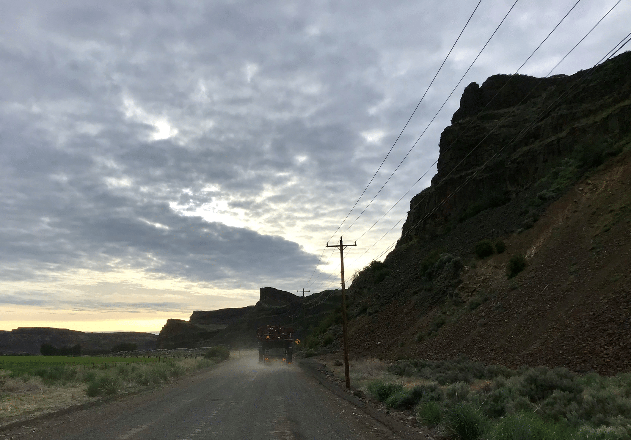
Not many more feet up the road I met a cold wind in my face and was forced to stop and add my “night time layers.” I pulled my headphones out of my ears and had my head on swivel while I changed right in the middle of the road, estimating how quickly I could dump everything and jump on my bike. Rock Island Grade is a reasonably steep road and quite exposed. I was thankful to be doing it in the cold wind because reports from previous XWA adventures occurred during the day and it was blazing hot in the sun. I didn’t get a view, but I think my way was much more enjoyable. The wind was strong enough to slow me down in one direction, then I would turn the other way on the next switchback and be able to upshift while still relaxing uphill with a tailwind, not a bad way to do the climb.
The next stretch through the dark was enjoyable. Not much to see but the road in my headlight. I would switch lighting constantly as I rode and the terrain went up and down. My dynamo would light the way down, then flicker as I slowed to climb, so I would turn it off and climb with my helmet light. I found I would turn the helmet light up when descending as well since I didn’t know the surface or area AT ALL and things came upon things very quickly. I also added a jacket to the long sleeve jersey I wore and kept zipping and unzipping to match my effort. These are the small, unmentionable tasks I choose to mention because they occupy the mind when there is nothing else to do so. For scale, the photo of the carcass was taken at 1:42am and I was only just getting past the obstacle I’m about to describe with a photo at 4:28am; that’s a lot of time spent seeing and experiencing nothing but the gravel illuminated in front of me.

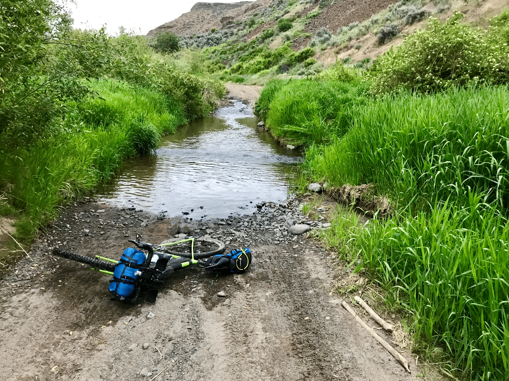
I felt like I was FLYING! Alert, strong legs, motivated by being at the front again, and some great tunes coming across my playlist. Then, something ahead of me as I descended. I couldn’t figure out what it was, just a blackness where a road should have been. My brain had trouble recognizing it and as I result I slid to a stop at the very edge of the water - a stream about 20ft wide crossed the road. I could see the other side, vehicle obviously just drove through it, and it was calm without obvious buried obstacles. On a warm day I would have just carried my bike across, but it WAS NOT WARM at around 4am! Okay, this is all relative. Garmin said it was 47F at this point, but the day before, while riding into Ellensburg, it was mid 70F.
Anyway - I was frustrated to be delayed. There were tall weeds, trees, and cliff-like banks on either side of the road. Nevertheless, I waded through the weeds and trees looking for a way around on either side of the road. Eventually I found some footholds on the left side which might allow me to bring the bike across dry. During this time I looked at trackleaders and was disheartened to see the RL dot had begun climbing Rock Island Grade already! I mean, already was 4am, not early in an ultra race, but my thinking was skewed. This was Ricky L, whose dot I hadn’t paid attention to before this. I don’t remember if I met him at the rider meeting and he left me on the first climbs the first day as part of a group, so I had never singled him out for evaluation. Now he was the closest, and apparently motivated, contender and would serve as my motivation for the entire next day of riding.

The first photo, with my bike in the water, is where I made it across. I didn’t note that I left my chain submerged to get this photo - another lesson learned. This second photo is on the opposite bank after taking entirely too long to overcome an obstacle which would have meant very little at a different time of day. There are compromises to every choice; Rock Island Grade was so much easier in the cool of night, but the tradeoff was a fear of simple water crossings.

The next section included a relaxed sunrise and lots of sand. I felt some looseness in one shoe and this time stopped immediately to tighten the same cleat which was coming loose again. This didn’t happen at all during my rides prior to the event. I stopped again within a few minutes as I felt a tightness and knew I’d once again set the cleat in the wrong position, but immediately fixed it to avoid the excruciating pain I’d felt the day before.

I believe there were 6 water crossings before I made it to my next landmark, the town of Ephrata. This was a beautiful piece of Washington State and I really should have enjoyed it more. As it was, I barely noted my surroundings. It felt like I came to another water crossing every five minutes (not true).
Two of the crossings I could find no way to walk around, but could jump across. I threw my bike into the grass on the other side and then jumped after it; thankful for a soft landing! One of them was very easy, and one I felt warm enough and just waded through, although I did take the time to remove my shoes and socks first.

This area with the multiple water crossings follows Douglas Creek, which is accessible by Jeep and the ilk, if you’re daring. There were several spots with tire tracks where I marveled you could get a vehicle not only into, but apparently also back out of (I’ve never been off-roading with a Jeep).
Eventually I exited the wilderness onto familiar roads - the Vicious Cycles Gran Fondo Ephrata passes over this area. My confidence, and pace, took a leap as I could actually picture what was around the next corner! Farms I recognized, and the Three Devils Climb, on which I somehow posted the fastest time (at time of writing) for 2019 (hint: the Gran Fondo didn’t use the climb this year) …

Not having studied the course well, it still felt like it took a long time to actually reach Ephrata. I didn’t take many photos here and it was hard to remember what happened. Looking back over my GPS track, I remember I had a hard time finding the exact Troy route into town. A gravel track followed a canal, but there was also a small path on the embankment which eventually dropped down onto a residential street. I spent a stupid amount of time trying to stay on route for what was probably only 0.2 miles of the course.
I headed for McDonalds and only remember that I ate quickly. I was feeling pressed by trackleaders. On a cell phone with spotty coverage it is hard to give scale to the dots. All I knew was EVERYONE was moving and seemed to be clearing obstacles faster than I had, although scrutinizing trackleaders now shows otherwise: Ricky started Rock Island grade only about 2.5 hours behind me and Aaron, Patrick, and Thomas all started the climb pretty close together about 4 hours after I did. Reaching Ephrata, Ricky was almost 3.5 hours back and Thomas, the first of the following trio, was about 5 hours back. At the time I just knew they looked close on the map and my energy was flagging.

Leaving Ephrata was a joy, provided by the only consistent tailwind of the trip. I did have to stop for navigational challenges. There was a split on a dirt road, which was a gentle “Y” intersection, and I couldn’t tell from any of my maps whether to go right or left. I eventually got google maps satelite layer to load and chose the right (also correct) path. This eventually lead to the “death wire” which had been identified by a trail angel (thanks Shawn P!) before the event and marked with highly visible ribbons - it is a single piece of wire strung across the road. With mostly flat ground and a tailwind I felt like I was flying and could have easily run right into it even in broad daylight. I snapped a quick photo as a thank you!
The surface quality deteriorated quickly and my pace slowed in spite of the tailwind because there were so many fixed rocks to avoid. I tried taking a video, which I’ll link below for a good laugh. You can’t hear much of what I was saying over the wind and you can probably tell from what you do hear than I’m tired. Nevertheless, here it is:
YouTube video of rocks; remember to right-click and open in a new tab!
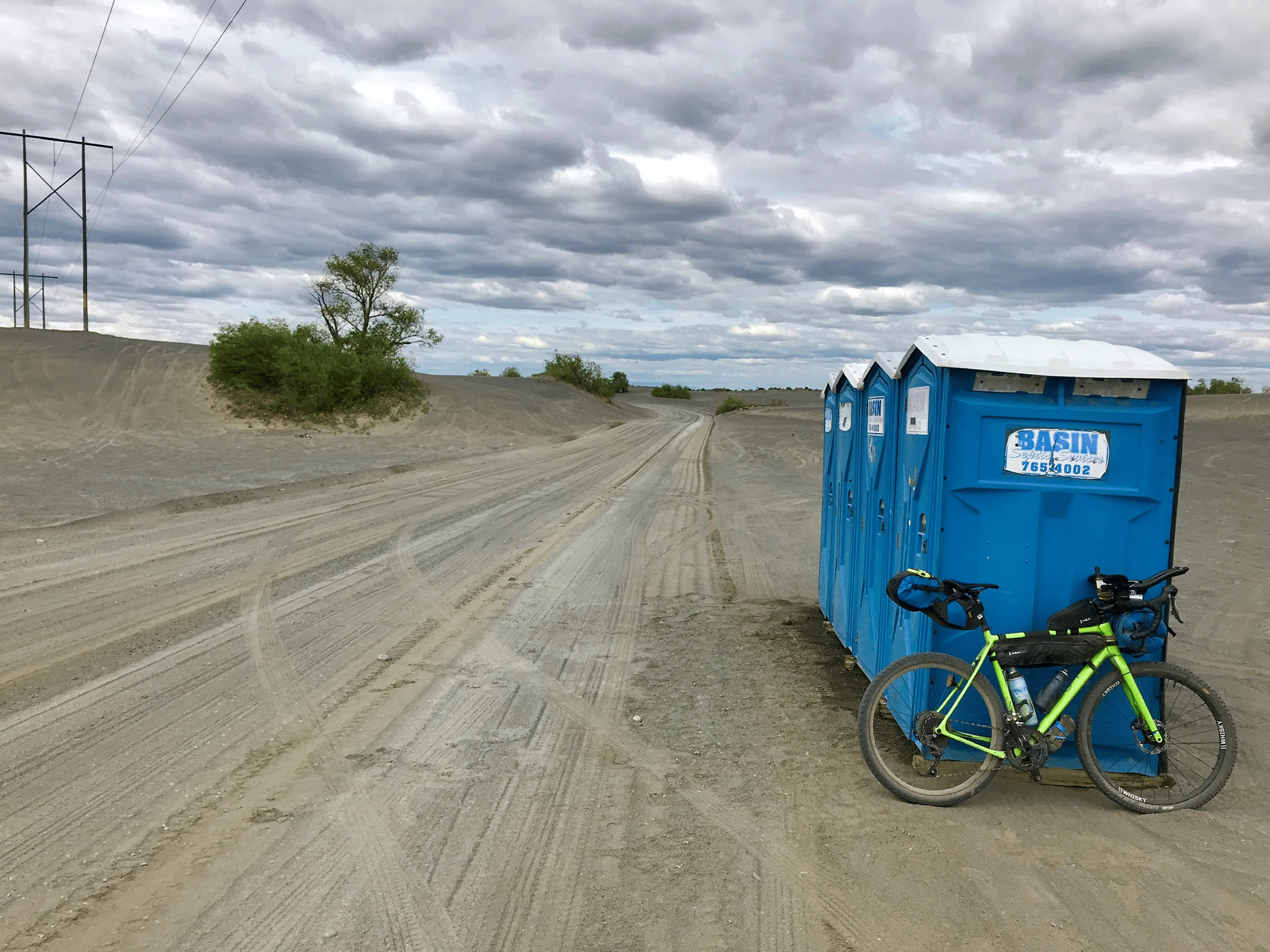
Next came Moses Lake, where I tellingly did not stop for a rest or supplies. The tailwind was a now a headwind and would remain so for most of the rest of the day. The route wends through an ORV park, which thankfully was mostly deserted when I passed through. Other XWA riders passing through later would find it a huge party full of campers, ATV’s, and alcohol. What we all got to experience though, was the soul crushing sand. There was no good line through here, the road IS sand. Each pedal stroke was part spin, part forward momentum. With a bit of heat and a lot of wind, this was very mentally taxing. My only photo was of my opportune potty break. One of the only vehicles was a construction grader reorganizing sand and the rocks below. I was barely going faster than the grader and had a difficult time getting over the ridge he created in the middle of the road to pass him. I actually had to stop, get off my bike, walk across the ridge, get back on my bike, and finally pass him at a painstakingly slow rate - we waved at each other.
The next stretch was alternating headwinds and crosswinds as the road took square turns. Then, a Troy Hopwood special. A left turn off a perfectly good road, so ridiculous I almost rode right past it. Into the sand again next to an unnamed tributary of Potholes Reservoir - and then there it was! The legendary carp pond! Really just a flooded section of road, but there were several dead fish laying both in the roadway and in the water, and it DID smell. There had been lots of talk about this before the event and I distinctly remembered a video the Kato’s took of them wading through the water and later posting about the “swamp bottom” they acquired as a result.
I was not game. I had seen an alternate road not so far back and I turned my bike around and took it. It was certainly not a faster detour, but I did stay dry. Some may think this is cheating and not following the route because even though it took me more time I didn’t have to deal with the hazard of foul water - not untrue, although Troy did say if we ever felt unsafe we should detour from the route and I felt like this qualified. No regrets.
Also a result of not studying the route ahead of time, I only planned on one water crossing, so this was a complete surprise. The first one I came to above Ephrata I had assumed to be THE one and only water crossing. Oops. After surviving a carping, the route bounced back up onto a road, the same perfectly good road I had left not even a mile back - oh, Troy is good, real good. How does he even find these things?!?

I can tell my energy was really flagging now looking back because I barely took any photos of a gorgeous area. The route through South Warden Lake is privately owned, complete with a sign explaining the owner wants to share it, and to treat it properly because he has the right to close it to use at any time. I really appreciated this, although not the ease of access. At the west end where the route enters his private preserve is a tall metal fence with a horse/deer/bicycle proof entry. No way to wheel my bike through, I finally just lifted it over.
The two track road winds through beautiful meadows and is decently maintained. For motorized vehicles anyway. The rock used on the road was deep and round making riding basically impossible. In order to pedal my bike through, I had to used the center of the road to escape the rocks, which would be fine if the “meadow” wasn’t about two feet tall and thick. I came to the exit of this area thoroughly exhausted from the effort of making progress, to be faced by a normal cattle fence.
This was much taller than the deer gate at the other end of the property and it had a combination lock. At first I wasn’t phased because we had received a code for such padlocks after receiving a permit for a section of the Palouse to Cascades Trail, which this was not a part of… The combo didn’t work and the gate remained locked. I stood in the wind and snacked for what felt like a very long time contemplating my choices. There was clearly no way around and NO WAY I was going backwards after all I’d just fought through. I could remove my bags from the bike to lighten it and get it over the fence, but that seemed like a huge amount of time as well. Finally I just moved without having really reached a decision and lifted the bike, climbed a rung of the fence, lifted it over the fence, and dropped it on the other side so it fell back, leaning against the fence. It was fast, but man that took a lot of energy.
I climbed over the fence after it and rode out to pavement through what felt very much like someone’s driveway, because it was. Pavement! Should have been welcome smooth sailing, but for the strong headwind and my exhaustion. I spotted a gas station at the next intersection. I zoomed out my map and saw the actual town of Warden wasn’t “far” away and it wasn’t long after 1pm. I decided not to stop but press on to the next town.
That decision almost broke me. Up to this point I could basically just ask my legs to keep pedaling and they would, although not with much power. I’ve read this described as someone’s “RAAM speed,” an obvious reference to the part it plays in that event, which is the average speed you can ride a bike when you have depleted your reserves, gone without sleep, and are asking your body to basically run on fight or flight autopilot. I couldn’t hold RAAM speed anymore. In the heat and headwind on that boring road being passed by cars, I was barely turning over the pedals. Everything hurt. My legs, my joints, my hands, my butt, my back, my HEART hurt. I began swearing with each breath, willing myself to keep moving - it eventually devolved into a repeated and barely audible “oh my god, oh my god…”
There was a slight hill into Warden and I remember wondering if I was already in my easiest gear when I came to it (I wasn’t). Creeping through town, I made it to a quaint gas station which thankfully was well stocked with beverages and ice cream. The real food looked unappetizing, but I bought a few things and made for a green space on the map in the middle of town.
I sat for a long time in the shade eating, drinking, and hoping to recover. My head felt foggy and my heart hurt. These were not good signs, but there was still so much daylight! I felt a bit defeated; I didn’t care to look at trackleaders, I was conscious it was too early to stop for the day, but how could I possibly continue in this condition?
I decided I must sleep; for how long I didn’t know. The park was kind of busy with kids, parents, and some guy who I was very uncomfortable with for some reason. On the way into town I remembered what looked liked a secluded park. Back on my bike, I backtracked only to find it was a municipality junk pile, not a park. Too exhaust to care, I dropped my bike under a tree only about 40ft from the main road and undid my sleeping gear for the first, and only, time on the trip. I inflated the sleeping pad, changed into sleeping clothes, and climbed into the sleeping bag and bivy. There wasn’t much shade under the one tree so it was very warm. The road was busy with the comings and goings of a farm town on a weekday and I zipped up the bivy to keep the wind-born dust out. Super comfy. I passed out - hard.
I awoke feeling completely refreshed, like wow I must have slept through the night! Because it was still daylight. A glance at my phone showed I’d slept barely an hour. How was that possible? I felt so good! I glanced at trackleaders, still in my sleeping bag. Ricky was closing in! Like, just outside of town kind of closing in! I jumped into motion, changed back into bike clothes, packed up the sleeping gear in an unceremonious fashion, and got on my bike. I stopped at the park again on the way out of town to top of my water and use the bathroom.
Although I looked over my shoulder a lot, I didn’t actually see Ricky as I left town. It must have been reasonably close, and he didn’t stop. Looking back on trackleaders I can’t tell how close because my tracker made a huge jump, not recording intervals for quite some time. This experience made me a believer in so called micro sleeps. The amount of time I rested seems inconsequential, but the energy I had leaving town wasn’t much shy of feeling 100%.

I set my next goal to be the town of Lind; a landmark in my mind because it marked a section of the trail which required a permit and as a result had come across many conversations leading up to the event. I had high expectations for Lind. The roads getting there were tough, mostly because of the wind, and I kept telling myself another gas station with ice cream awaited me as a reward for pushing hard. I was thoroughly disappointed. When I arrived at Lind late in the afternoon, the only open businesses were the bars, and they sounded rowdy from the street. Not usually one to be shy of such experiences, I wasn’t willing to walk into a full bar in my cycling kit. Instead I found a vending machine down the street and bought bottles of water to resupply. I wheeled out of town just in time to be stopped at the rail crossing for a train, couldn’t have planned that if I’d tried!
I should mention that during normal business hours Lind is quite welcoming, not the least of which because of a fantastic coffee shop, Kindra’s Coffee Bar; fast friendly service and incredibly welcoming to cyclists - she’ll ask you to sign her wall!

Ricky was still coming. Trackleaders, at the last dependable spot, showed him less than an hour behind. I stopped looking as I left Lind. I don’t think there was cell coverage to speak of anyway and the trail was very rough, making it difficult to ride without both hands on the bars. After that train crossing, the route jumped back onto the Palouse to Cascades Trail (the permit we couldn’t get was the section between Warden and Lind). The trail was very rough here and I spent a lot of energy focusing on keeping my pace up while not hitting a rock and ending my ride. I found it necessary to lean into the aero bars to keep momentum. This also saved my hands and my backside from the beating, transferring much of the abuse onto my arms, shoulders, and back.

This last photo I snapped about 8:30pm shortly before turning on my lights again. Gorgeous sunset! I was in good spirits for another hour. About 9:30pm the route left the flat, if rough, trail and took gravel roads toward the town of Ritzville, my goal for the night - and sleep! Things went downhill for me quickly. The road was rolling compared to the trail and my rhythm was broken as I was forced to climb. The climbs weren’t steep or long, but I didn’t have much gas in the tank left for them. Then it started to get cold. Again, this is all relative; the temperature in Warden was mid 60F and riding through the night to Ritzville shows low 40F. In my depleted state this felt VERY cold, especially when the road tilted downhill. I stopped a couple of times to add layers.
I was making such slow progress I began to worry, and look at the map a lot. Ritzville was not far away, but I was going slow. I gradually hit the wall again, the same feelings of exhaustion that I experienced maybe 7 hours earlier on my way to Warden, but much worse. I really thought I was in trouble. I was sure Ricky and others would blow by me at any time since I was going so slow. I had all but my emergency down puffy on and I was cold. I was hungry, but none of my food sounded good. I was rationing water because it was starting to run low. It was pitch black but for what my headlight illuminated. And I was tired; if you remember I’d only had that hour of sleep under a tree since North Bend!
Gradually I relapsed completely to my state before Warden, complete with swearing with each breath. So much saddle pain! This wasn’t the usual discomfort of being on a saddle for many hours where you may develop chafing, a rash, saddle sores, etc, but beyond. This was cumulative pressure on soft tissue over days adding up to this moment in time where it felt like I was really doing damage and there was no relief but for brief moments of standing on the pedals, and I didn’t have enough energy to do that for more than seconds at a time. The rolling terrain made it difficult to stay in the aero bars and my back wasn’t happy with that anymore anyways.
I tried all the mental games to will myself forward. Distractions, calculating mileage vs time, nothing could keep the pain away. I considered stopping and just sleeping in some ditch or copse of trees, but the cold and my dwindled supplies made me feel like that wasn’t a safe choice in my condition, so I made myself keep pressing on the pedals. Eventually the road turned to pavement, then cars started passing occasionally, then I could see and hear the interstate! Who knew that would be such a welcome experience on an off road bikepacking trip??
I wheeled into the, quite busy, Love’s Travel Stop, and stumbled into the bright lights and loud sounds of it’s Carl’s Jr restaurant. I must have looked like shit, maybe even smelled equivalently, but the guy was nice and patient as I faltered to make a decision and then voice my order - it included a milkshake even though I was only just warming up. Scarfing down calories as quickly as my angered stomach would allow, I checked trackleaders and was relieved to see all of the pursuing dots had stopped for the night. Maybe my ragged push into another night would pay off in spite of my condition?
I consulted my phone for sleeping options. Several hotels close by! Understanding my low energy, I realized I should call ahead instead of just riding to one aimlessly. Good choice; the first three I called were completely booked! Finally I found a mom and pop style motel who kindly answered the phone and said they had a room. They DID ask me to confirm I was coming right away.
Stuffing my remaining food onto my bike somewhere (plastic bag on handlebars I think), I wheeled into town and found the motel. My phone call had clearly awakened them and they checked me in, bleary-eyed in their pajamas. Door closed behind my tired ass, I finished my meal and showered.
I set an alarm for only 4 hours of sleep. I was only about 100 miles from the finish and I had pushed through so much to get this far, I couldn’t imagine a full nights sleep. After my micro sleep under the tree, I also thought 4 hours sounded like more than I needed.
Gaining Ritzville was the single hardest thing I have physically done in my life.
Click the link for the next segment:
Day Five: Riding with Thomas and the Finish Line!