Day Five: Riding With Thomas and the Finish Line!
I woke up - PANIC AT THE DISCO! My alarm wasn’t going off and I could see daylight through the curtains!
I grabbed my phone; I’d overslept, which meant I must have turned off my alarm without fully waking. Oops. I’ve learned this lesson before. There were various periods in my life I had to set multiple alarms and keep them all out of reach; my phone had been inches from my face on the motel night stand.
A look at trackleaders confirmed my fears - everyone seemed to be moving. Later, several dot watchers would tell me this was the most stressful part of the event; my dot just stayed off-route in town while everyone else descended on me after all that work and pushing through. Thomas was passing into Ritzville as I watched, with Patrick not long behind him, and Ricky moving again also not far behind.
Although I packed as fast as I could, I resolved that I would not be winning this race. I hadn’t paid attention to Thomas’ dot since Wenatchee but I thought his spirit had broken and may not finish the event. Now the always faster rider was upon me from who knows where and I didn’t imagine a scenario where I could pass him again - we assuredly had the same goal to finish the last 100 miles without another sleep. My goal became to catch him before he left town and congratulate him on the strong finish to bolster his spirits and keep him ahead of the chasers.

It was still early and the motel office was not open. I couldn’t figure out how to check out and didn’t want an accidental charge, so I rang the doorbell. Unfortunately, I had once again woken them from their sleep. Bleary-eyed, they waved to the mailbox as a place to leave the key - thanks! I was off without the included, but not yet ready, continental breakfast.
Thomas didn’t stop though and I didn’t catch him before he left town. Knowing the gap must be small and feeling better, I hoped to catch him, if only briefly. I did take enough time to resupply at the Love’s. A routing error right out of town slowed me down. The route took what appeared to be a freeway onramp and I struggled for a bit, eventually discovering a side road turned off just before the highway.
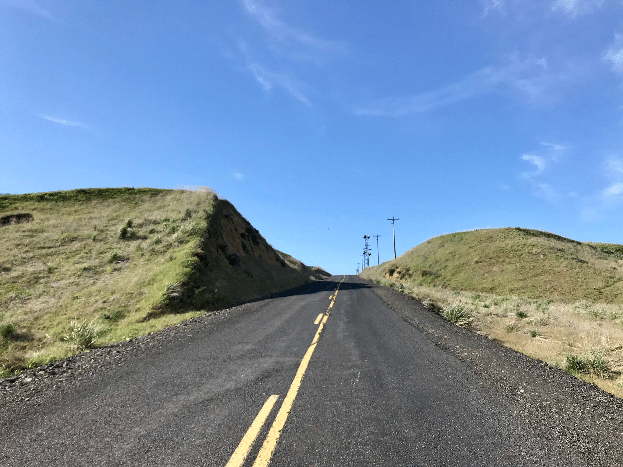
This bit was mostly paved and should have been easy, but the wind was back and STRONG! I found myself descending on pavement worried I might be blown off the road. Another steep descent with sketchy wind like this ended with a tractor blocking my lane; I moved into the passing lane only to meet the farmers dog head on! He looked friendly but was running straight at me while I was going close to 40mph! A brief game of chicken and maybe my high heartrate for the day, I made it past him by what felt like inches.

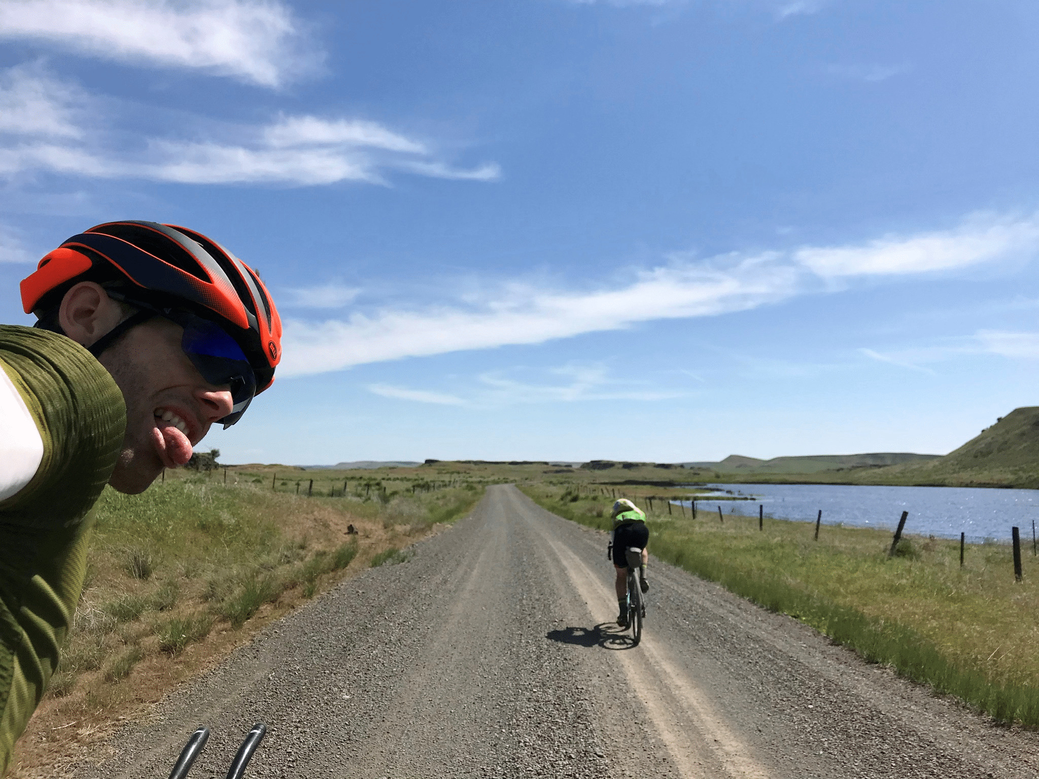
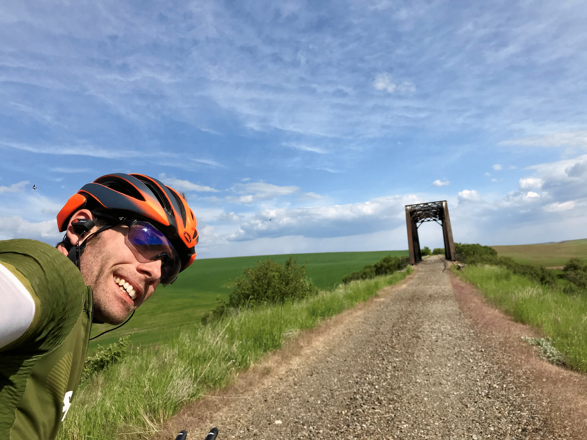
Somewhere just shy of 9am, there he was! (the above photo is not the moment we met, but later down the trail) The route turned off the road and under a bridge; straight into a cow pasture. Thomas was on the wrong side of a fence line. The route followed the fenceline and it was nearly impossible to tell if we should go through the gate on the left or right side of the fence. He had taken time to add sunscreen after figuring out he was on the wrong side which gave me time to catch up. We chatted for a bit and decided to ride together!

For this section of trail having a buddy was especially useful - there were a lot of gates. This first one, on the correct (right) side of the fenceline, took both of us to reattach it was so tight! I’m not sure how others did it solo.
As the miles melted away we chatted as much as possible through the wind, which meant yelling. We had both been through a lot and would have been just as happy if the other had finished first, so we resolved to finish the route and cross the line together if possible, with the caveat that it would work only if we could stay ahead of the others.

This proved too difficult for me. Thomas slowed his pace for me, but between the difference in bike weight and my experiences with exhaustion the day before, I really couldn’t keep up.

We took a few photo stops even - what a stunning area to finish the race! We both had the energy and optimism to mostly enjoy it, in spite of the wind.

It was a real boost for each of us to have some company in what had been an almost entirely solo experience. It looked like the dots were gaining on us though and I repeatedly tried to let Thomas know I was okay if he pressed on. He was nice enough to find excuses to stick with me for awhile.

This ended up being the warmest day we had with temps reaching into the 80F range. It meant I used more water than I had on previous days, and resupplies were few and far between. We stopped at a small pond which was close enough to the road I could filter water from it without contending with fences. There were many bodies of water along the way, but varying degrees of inaccessible. This one smelled funny and the water was nearly brown in my filter. I tried it, but it tasted bad and I decided it was in case of emergency only.
Somewhere in this stretch I convinced Thomas to keep going his own pace. I was really toeing the line between “RAAM speed” and the exhausted survival I’d felt the day before. Trackleaders showed our pursuers, still Ricky and Aaron, were less than two hours behind. I was worried if I kept trying to press my pace I would cross the exhaustion line again and not be able to finish at all that day - far worse than slowing and just getting there.
Thomas and I had barely separated when we came to the “town” of Ewan; barely a stop sign. There was, however, an abandoned church at which there was rumored to be an outdoor water spigot. We found it and it ran with water! Although, the water didn’t look much better than the pond water I’d tried. An elderly gentleman was walking through his front yard across the road with a cane and greeted us - “Do you need water?” OMG what a great guy! He let us walk over onto his lawn and use the spigot on his property to fill all our bottles, extra containers, and drink our fill. He explained a pipe had burst over the winter and he didn’t expect the church pipes had been cleaned out since; “I wouldn’t drink that.”

From Ewan we did ride separately. I had trouble getting started again, but eventually settled into a pace I was comfortable with. The route left pavement and followed gravel farming roads; up and down it went, with that ever present wind mostly in my face. Nearing a town called Pine City, I came down a fast hill and missed a left turn - it was a double track farm road down a steep bank, but the only option I saw at speed was the actual road to the left. I rode for awhile a bit confused and wondering if I was off route or just had GPS drift. Then, a right turn which wasn’t there. I stopped and peered through the trees; I could just make out, down below in the valley, the road I wanted crossing a bridge and turning right. Crap. I turned around and found the correct way.
This was one example of some difficulty I experienced along the way following the route. Remember how I had navigation issues back in Edmonds and eventually loaded a new route in the Target parking lot? Well, the route I had saved to my RWGPS account and subsequently loaded to my Garmin was a “pared down” version with fewer control points. Route builders do this to make it easier for devices to load and navigate large routes. A downside is that with so few control points you end up with less detail and lots of straight lines where you actually are making minute turns.

I really enjoyed this next stretch, a bit of peace and relaxation in what had been a rather hurried and somewhat torturous few days. The correct road I ended up on was quiet. It crossed a small bridge over a fast flowing creek and the right turn led to a gate on the trail. Yes, again on the Palouse to Cascades Trail here! On the other side of the gate was a herd of curious cows. It was so quiet the only sound was the creek under the bridge and the occasional moo. I passed through the gate, locking it behind me. This was the day our combination code was really put to use, over and over and over again!
The cows ran away, probably out of boredom as I can’t imagine I was very threatening. I grew up on a dairy farm so this area was rather nostalgic - complete with my musings about how stupid cows are. The trail was raised above the pasture and the cows ran alongside below me. I could see their well worn trails through the pasture which must have been traveled hundreds of times, and yet they crashed into each other or stumbled over logs which could easily be navigated around.
I had only the pine cones to contend with - the pine cones! With this turn onto the trail and pasture land came the beginning of the pine forests and with them a distinct smell I remembered from a family vacation to Idaho from years before. I’ve read that, of all our senses, that of smell has the most direct link to memory. My heart jumped for joy; the smell meant we were at last nearing Idaho and the finish line!
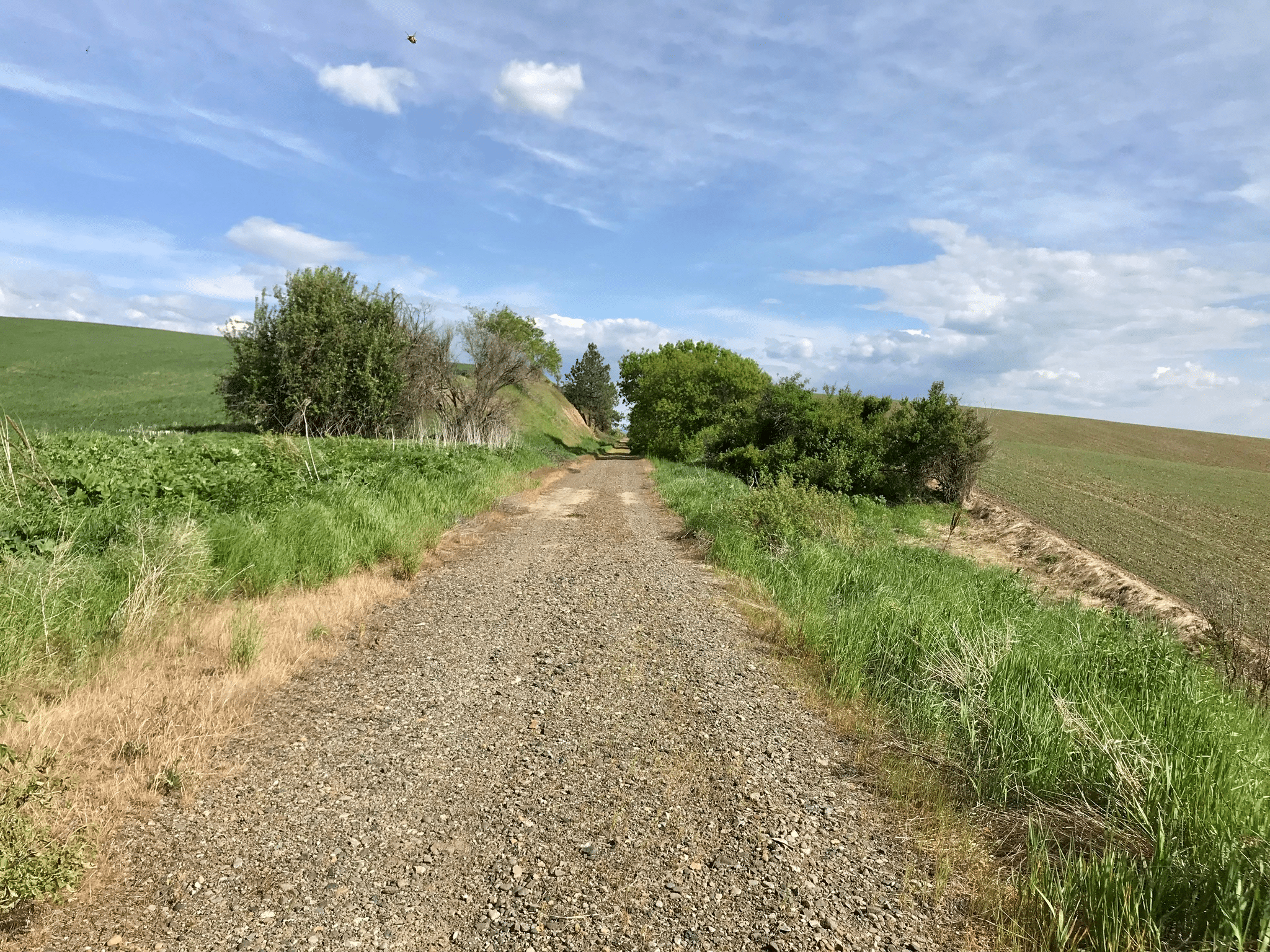
The route passed through much pasture land and small towns on its way to our last refuel stop in Rosalie. There were several partially converted rail trestles with barely passable board surfaces - mind the nails! The pine cones were also quite large and to be avoided where possible.
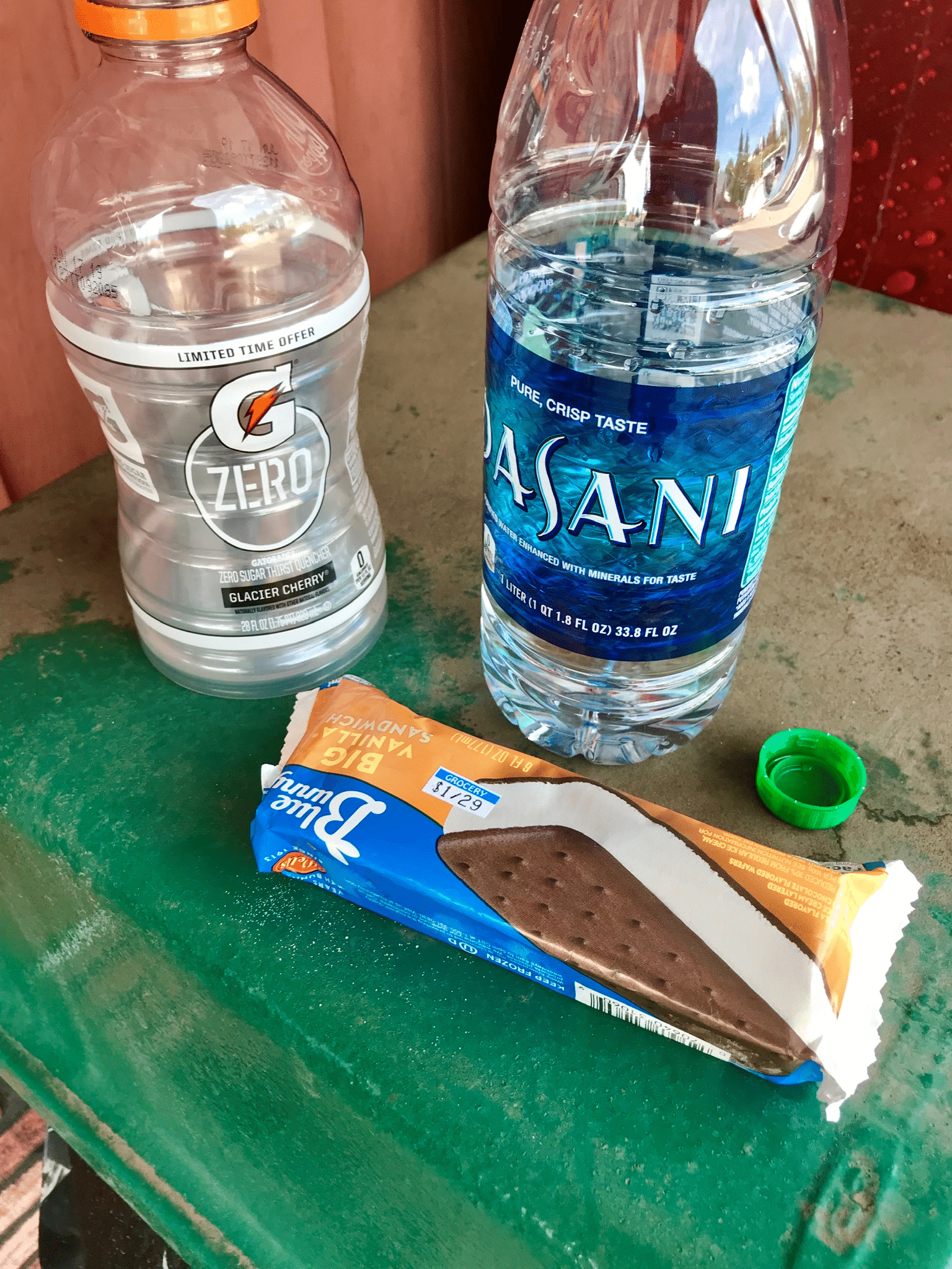
Much like Lind, I fantasized about reaching Rosalia. When I finally rolled into town I was still in high spirits and looked forward to ice cream in the heat. I chose the Rosalia Market as my refuel point in town and was rewarded by a wide selection. Standing outside with my Frappuccino and ice cream, I swapped text messages with the ever encouraging Lo. This time, urgency! Thomas was only 20 minutes ahead?! How was that possible?! I was having trouble getting trackleaders to load with poor cell coverage. And Ricky? “Yeah. Now get your butt moving!” was the reply. I stuffed a cheese danish and my second ice cream sandwich in my jersey pocket and took off!
I managed to eat the ice cream sandwich before it completely melted all over while riding. Eventually I got trackleaders to load and confirmed Thomas really was only a short distance ahead! Ricky had put a large gap into Patrick but was still almost two hours behind me. I felt pretty comfortable with that.

It quickly became clear Thomas was not going slowly and I was still near that line of exhaustion, so I tried to relax and enjoy the final 30 or so miles of the route. There was even trail traffic briefly. In this part of the state the trail is very much used to move farm equipment between fields, and the equipment is huge! The above photo is an example. The tractor facing me was coming down the trail at me but thankfully his destination was the spot I met him because his width took up the whole trail.

I’m glad I took so many photos because this really is a beautiful piece of the state and we had a nice day to enjoy it.
There was nothing free about it though; every mile had a price. The farm traffic made some sections of the trail very difficult indeed with deep ruts, standing water, and mud.

Gratuitous photo insertion - I accidentally captured a bee as he swerved to avoid me at speed.
Many trestles, some intact, some gone, some had to be detoured around entirely. One in particular routed through a grassy shoulder up onto a paved road. With no discernable track through the grass, this was hard to follow with my pared down GPS route.

Some areas, like the mowed grass here, seemed to indicate some local farmers took an interest in maintaining the trail for more than just tractor traffic.

This mud was so thick it stopped me in my tracks. On a full strength day I could likely ride through this; with the heavy bike and low energy level, walking was the obvious choice here!
Somewhere in this area I met Stacey, Thomas’ partner, riding the other way to encourage us in our final miles! I definitely hadn’t expected that, and it WAS so encouraging!
The route passes through the outskirts of Tekoa before heading to the Idaho border. It is tantalizingly close, it’s siren song steering more than one rider this year to a premature finish in its warm embrace! Continuing past, I at some point glanced down at my Garmin and was rewarded by reading on the map “Idaho Road Ahead!” What a welcome sight! So much so in fact that I stopped and took a quick video:
YouTube video of the moment I knew I was almost there. Remember to right-click and open in a new tab

Somehow I don’t actually remember a sign or anything at the border itself, but there is clearly a right turn onto the farm road which follows the border back south toward Tekoa. This was where the mud and standing water really took their toll. I had ridden through much of it in the interest of speed, and frankly, a lack of other options. My bottom bracket slowly began to make noise. I felt like the turn at the border was where it really ramped up. I’ve never had a bike make that much noise and I was genuinely concerned something might break and I’d be running for the finish to beat Ricky - not a welcome thought! I documented the occasion, of course:

Thankfully, it held together. These rolling farm fields were impressive in their gradient.

Up and down, it didn’t seem like it would ever end! Thankfully we came through when it was dry because I’ve heard this stretch is terrible in the wet. I would zoom down one side of a hill, navigate the washout at the bottom, try to carry speed up the next hill, then shift into the easiest gear and grind up the rest slowly. A few were sized just right you could carry momentum all the way up. This would be a lot more fun on an unloaded bike with fresh legs, although I doubt I’ll make the drive back just for that.

And then suddenly, the last hill! The “end” flag on my map was super close and I could see into town! It was a nice straight steep drop, right past a local baseball game, safely cross the street, and into a little park in the middle of town!
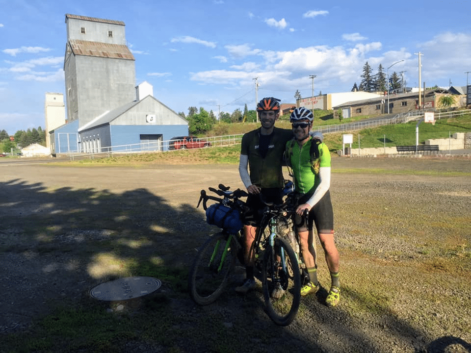
Thomas, Stacey, and Frank, from the Tekoa Trail and Trestle Association, were there to welcome me in. Stacey grabbed a photo while we were both still standing.

And the prize! Confirming a second place finish in the hardest (multi-day) ride of my life.
We drank fluids, ate some food, and took comfort in the sweet feeling of completion. I had only a tentative plan to get home. One option offered was that if we finished close enough together I could stay with Thomas and Stacey at Tekoa Lodging in the middle of town and ride back with them. We ate in town and made it back to the park in time to welcome Ricky to the finish!

We settled in for the night. At some point, maybe around 9:30pm, Patrick’s mother was inside the building calling out if anyone knew where the finish line was? We gave her directions; she was on her way to greet him as he finished his ride. She asked about our rides and congratulated us, mentioning that “Patrick said this was really hard and he doesn’t think ANYTHING is hard.” Seems accurate. We would later find she picked him up at the Idaho border, his personal goal for the event.
Aaron and Nat would go on to spend another night afield. We were able to greet them in town the next day after they finished; and Valerie shortly after as well! Everyone looked so relieved to be done, each having gone through their own ups and downs with challenges aplenty to overcome.
What a fascinating adventure, and for this cyclist, certainly a gateway drug to other events of this sort. Out of all the types of cycling I have tried, I find this to be the best challenge, most rewarding, and most enjoyable. I’ll be back!
I wanted to send a special thank you to all the “dot watchers” out there! Knowing there might be someone somewhere in the world refreshing the trackleaders page and wondering what I was going through was great motivation. Lo helped form a dot watchers group for Thomas, Aharon, and I using Facebook Messenger sometime during the trip. We were added to the group after the event and could read back over all the conversations - so exciting! And what a great community of cyclists (and my sister!) etc we have around us, very thankful for sure!
And last, thanks Troy! For an incredibly “creative” route and the personal challenge it provided so we could all grow. The day after I finished I sent him a message saying something like “I can’t understand why anyone would ever do your route a 2nd time.” Looking back, as the difficult times and the physical pain have faded from memory as they do, I would do this again. Especially if we didn’t have to take this route over the Colockum again…
… The adventure isn’t entirely over. The third member of our party had yet to finish and his “homecoming” is deserving of it’s own story!
I was also encouraged to share a gear list explaining what I took on the trip and what worked or did not, so I’ll link that as well. Although if you’ve read to this point you probably get the idea anyway!
Click the link for the next segment: